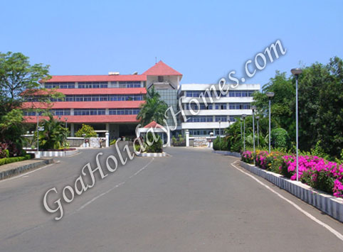
Mormugao
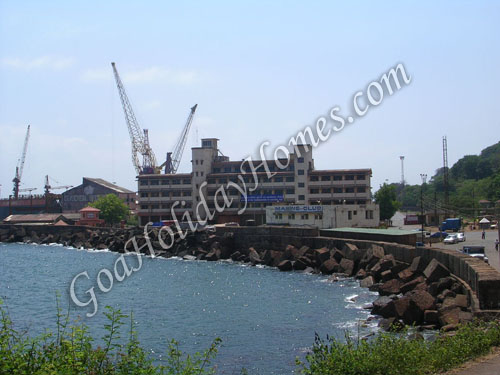
Mormugao was created for administrative purposes very recently in 1917 due the urbanization of the Vasco Mormugao area and the significance of Mormugao as a port town. This port town was initially a headland with the presence of a great fortress built in 1624 similar to that of the Fort Aguada at Sinquerim. This fortress became the official residence of the Portuguese Viceroy, Caetano de Melo e Castro who selected it as the capital of Old Goa in the early part of the 17th century.
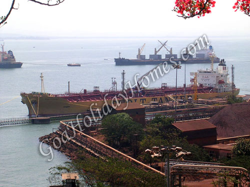
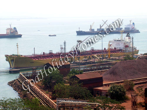
Unfortunately, the project for the capital was scrapped on orders from Portugal and the fortress served as a military base. Its importance as a port grew immensely with the railway station coming up thereby increasing activities in trade and commerce. Mormugao was created from a part of Salcete and a new town Naveed Vasco Da Gama was built, the port area retaining its original name as Mormugao and being one of the 3 villages at the site on which Vasco was built. The industrial development of the state increased due to the airport built at Dabolim on Vasco outskirts. The road to the Dabolim airport gives a fair indication of the sights and sounds of Goa. Dabolim is believed to be the site of the stone age remnants. Just after the airport, on the road down the hill is Chicalim, which offers a brief glimpse of the Vasco city. The right side of the road on the hillside leads to the site selected by Goa�s early people who have left traces of their earliest dwellings which can be seen through holes cut into the laterite hill and broken pieces of early pottery. The Carmelite Nuns are the latest inhabitants of this area who founded a convent in 1947 in this area.
The stretch of road towards Vasco is quite dusty and gives a perfect outlook of Goa�s slow life. All along this road, one can find the material used for Goa�s roads, all plastered only to a certain area from which red dust is scattered all over by the large lorries and trucks. There are many fruit bearing trees amidst houses along this wide stretch of road which seems never ending till infinity. There is an islet just further named after the chapel of St. Jacinta which has a fisherman�s edge and a few landing steps and is linked by a small causeway. The area is quite lush green with glossy cashew bushes surrounding this islet on the rocky shores of the estuary.
The road further to the shoreline leads to the village of Sancoale which is the site of the Church of Our Lady of Health which had been destroyed by fire in 1834 with the only remnant being the central section of the church fa�ade. It is still venerated as a National Monument well proportioned with arched side entrances and well decorated panels to be ranked with Goa�s finest church designs. The road across the estuary opens out to the Tiswadi shore where set in wooded slopes, is a white church which was built in 1560 on the spot where the Jesuits celebrated their first mass on arrival in Goa.
It is dedicated to 3 famous saints, where their feast is celebrated. This is the village of Cortalim, the original site of the Mangueshi temple. There is a sanctuary just nearby this church dedicated to St. Philip Neri and is built in the memory of one of Goa�s famous sons, Fr. Joseph Vaz, who was baptized in the church here. He has contributed to getting recognition for Goan priests protesting against the Portuguese ideals and partiality towards accepting native priests and ordaining them as members. This recognition was obtained by him inspite of stiff opposition by the Goan archbishop whereas soon after he left Goa to associate himself with the Cross of Miracles. He stayed put in Sri Lanka until his death in 1711, and became very famous for his missionary work there. He was canonized by the Bishop of Cochin in 1713 and special prayers are offered both at the Church of Cross of Miracles as well as the Sanctuary.
The short stretch of road from the airport ends at a junction at Cortalim which was one of the busiest ferry stations earlier. The building of a bridge over the Zuari in 1983 has made the ferry station dormant although it still connects with Madkai (Markhai) on the Ponda shore. From this area on the left, one can still get views of the fa�ade of the old Sancoale church, the island of St. Jacinta and the Mormugao headland with its port. The right side forms a tiny islet which leads to a distant land port extending the promontory of Dona Paula into the sea.
Contact Details
Get Directions:
Photo Gallery
Google Map
-
 Beaches In Goa 60
-
 Dances in Goa 7
-
 Entertainment and Night Life 19
-
 Festivals in Goa 6
-
 General Information 1
-
Goa and its culture 21
-
 History Of Goa 14
-
Information 32
-
Museums in Goa 20
-
 Places To Visit In Goa 47
-
 Religious Places in Goa 76
-
Things to do in Goa 27
-
 Tourist Guide 3
-
 Villages and Towns 131
-
 Watersports in Goa 2